Category Archives: Activities

Flying into LAX all by myself

A Youtube video by Niko’s Wings of a night approach and landing at Chicago’s O’Hare reminded me that I had done a similar stunt a bit further west at LAX.

If you have no first-hand experience with the navigation of the airways you will not know that landing at one of those big airports like O’Hare is virtually impossible for a private pilot with one fan in front.

You sometimes get routed through a Bravo airspace (the highly protected space around major airports) but to enter, you have to get explicit permission in the form of a clearance like “Piper Warrior N8300L cleared to enter Bravo airspace.” But landing at the airport that this Bravo airspace protects, you don’t’ even think about it  – – –  normally.

But maybe I am not normal. So, in the 90s, I was playing in the airspace west of Burbank – my home airport,  one late night, probably after 1 am. The radio was quiet most of the time and suddenly the idea hit me – why not shoot a practice approach into LAX, just 20-30 miles to the South-East.

So I tuned into LAX approach (now SoCal approach) – “LAX approach, PA28 N8300L, request!” I might have woken up the controller but he came back shortly “N8300L, LAX approach, go ahead.”

I gathered all my courage and asked for a practice-approach into LAX. Unfortunately, the answer was that no practice approaches are permitted at LAX. But – – – you can have a full stop landing. Wow – that was even better! For all you non-flying peeps, a practice-approach is the pretense to land at an airport as if there were clouds so that you have to land only using your instruments. Then, when you are close enough to ensure a safe landing, you give full power and get out of there – often turning around, flying another approach – that’s why it’s called ‘practice’ approach.

Now, really landing at LAX with my Piper Warrior – that would be something to tell the grandchildren about, many, many years later.

So, yes, Sir – I’ll take that approach and landing at LAX!

I got my clearance into the Bravo airspace and radar vectors to the ILS Runway 24R. (ILS stands for Instrument Landing System – a radio signal coming from the beginning of the runway that guides us down to the landing zone vertically and horizontally.)

And then I flew like a young god – holding my assigned altitude within 50 feet and pegged my directional gyro exactly where the controller had told me. I intercepted the ILS and slid down towards 24R.

Then it was time to switch from approach control to tower. Just saying “Los Angeles tower, Cherokee 8300L with you for 24R” grew some serious hair on my chest.

But I did not get to complete my landing at LAX after all. Tower told me that I should finish my approach and then fly a missed approach. That was the friendly way of giving me my practice approach without violating their rule that there are no practice approaches at LAX. It might have been a bit of a loss for me but, on the other hand, I might have owed LAX a landing fee.

I was handed over the approach control again which guided me out of the Bravo airspace and shortly I landed at my home base Burbank, tied down and went home a hero.

A not quite International Airport

(This is a little story that I wrote in my blog before there were blogs.)

I loved this little air strip of Jerry and Lucy up there in the High Sierra. But I was also afraid of it. It’s one of the places that pushed me to make the decision to learn to fly. Imagining the romantic feeling of flying a bi-plane, wind in your hair, into a strip out there in the wilderness. Here is a strip like that. I call it Jerry’s paradise. Because it is! The last time I was up there, Jerry told me they had been there for thirty-seven years now with no intention to leave.

Nearly every aerodrome looks small when seen from the distance. However, most of them get bigger when you come closer. But Jerry’s airstrip, even when you are close enough to make a decision to land…

ng_12

…still looks really small.

During primary training, my instructor always complained when I did not land exactly on the centerline. I never really understood it, because on a runway like Burbank’s 8 there was so much space on both sides, so who cares about the couple of feet to the left or right? On Jerry’s airstrip, you just don’t have a couple of feet to the left or right. There only is the centerline.

After touchdown on Jerry’s airstrip, I always tried to get trusty 08L stopped before reaching the middle of the strip because there is a mown area to the right of the actual runway to tie down a couple of visiting planes. Never managed to do so though. Always still had a bit too much speed and had to run all the way to the end of the strip, turn around in Jerry’s yard, and taxi back to the tie-down. One of these days I will manage – I promise!

Takeoff, in contrast, is rather easy for me. This one time my friend Ron, with whom I stayed for the weekend up there in his mountain hotel, dropped me off at 08L’s parking space and took a nice series of shots of my take-off. I thought I share these…

ng_to1

Going through the pre-engine-start checklist

ng_to2

CLEAR PROP !!

ng_to3

Increase power to start rolling – and it takes quite a bit of power to start rolling on the grass and dirt.

ng_to4

Taxi back towards Jerry’s Yard.

ng_to5

I really had to figure out how to turn in Jerry’s Yard without getting out of the plane to push. It’s a bit too narrow to turn directly, so I use the technique I learned in driving school for turns in narrow streets: All the way to the right, then a sharp left turn toward the curb, followed by backing up with a right turn – –  only 08L does not have reverse! Fortunately, the yard slopes up, so my left turn goes up a slope a bit and gravity helps me to go backward – – then another left turn and the 180-degree turn is done.

ng_to6

Aligned with the runway with Jerry’s yard behind me, Checklist, Ready for Take-Off! No need here to announce my departure on Unicom frequency – first, there is no Unicom frequency, and second, Jerry would have told me had somebody else announced his arrival.

ng_to7

Gaining Speed – 30 Knots

ng_to8

Rushing by Ron at 40 Knots

ng_to9

Reaching Rotation Speed at 60 Knots

ng_to10

Staying in Ground Effect to Gain Some More Speed

ng_to11

Leaving the Earth Below!

Reaching 4500 feet, 500 above the strip, I turn around, fly over the field once more, and rock the wings to say goodbye. Then it’s climbing nearly all the way to Bakersfield to get up to 9500 to get enough altitude between me and the Grapevine. Crossing Gorman VOR, I start letting down slowly until I’m at 5000 over Magic Mountain

Airial Shot of Six Flags
Six Flags
which looks so insignificant from up here. Still, I don’t think anybody would ever get me into Colossus, Ninja, or Viper.

And then, just a little bit later:

“Burbank Approach, Cherokee 8308L, over the Magic Mountain, five thousand, landing Burbank with Information Alpha.”

Making a House my Own

We found a real nice house that is more or less perfect in many regards:

  • big enough
  • lower priced because it needs a bit of work
  • close to friends
  • quiet area
  • big RV garage to be used as storage for business
  • owner very motivated
  • owner open to creative financing
  • open space
  • big property – third of an acre

Altogether, it just feels right, we all like it – so we want it.

Now we just have to create the reality that within a month we move into this place and one of the reasons for this blog post is for you all to help create this reality.

So, now altogether please – create the picture of us being in this house with plenty of money left over from the sale of the old house. Oh, yes, and the old house is bought by a friend for whom it would be real good as he wants to have a family.

On the Trails of JD Flora – Revisited

Last year I took my son out to Death Valley for a day – and night – he loves to be in hotels! We stopped in Stovepipe Wells for the night and continued on to Furnace Creek the next day. This trip was done on the ground but it still reminded me immensely of a research mission the custodian of the Logs of JD Flora and I conducted many years ago. I reported about that mission on the web in something that today would be called a blog. The pages are still there but hidden in the deep crevices of the internet, so that I though I dig this all out and present it here again – on a real blog.

Here we go…

What!? You don’t know who J.D. Flora is? I would say that you better find out. Otherwise this story will not make very much sense. I will wait here until you are back …….
……
……

So, now you know our hero. You also know or will find out that Dr. Joachim Steingrubner, the lucky person who found the logs of J.D. Flora and I went onto a mission to follow the tracks of our hero.

From the logs we learned about J.D.’s one flight to Tehachapi, Mountain Valley. There, on his heading of 10 degrees at a distance of 12 miles he encountered the unexplainable – at least for us. Will we ever find out what happened?

On another flight J.D. Flora, or Jetty, how he is now sometimes called by his fans, made a flight to Stovepipe Wells and Furnace Creek, again with unexplainable but steamy events happening.

Dr. Steingrubner as the historian and chronist as well as the researcher of the J.D. Flora logs decided that a mission was in order to follow the trails of the subject of his research. I was to participate in this project as the pilot in command. The interested reader can follow the trail on a World Aeronautical Chart.

World Aeronautical Chart

On a fine sunny morning we met at the Pilot’s Co-Op at Burbank airport, ready to follow the trails of J.D. Flora.

Dr. Steingrubner had the appropriate excerpts from The Logs so that we could review it for our first leg. From the IRC communication between SFYNX Remate Agent 3 and J.D. we learned:

SFYNX-RA3> From your recent e-mail I conclude that you want to
SFYNX-RA3> go flying today or tomorrow morning.  How about going to
SFYNX-RA3> Tehachapi for a snack ?

JDF> It's quite a humble, but healthy cuisine they got there, but I'll
JDF> consider this.  Any reason for this ?

SFYNX-RA3> Of course.
SFYNX-RA3> From Tehachapi, if you fly heading zero-one-zero
SFYNX-RA3> degrees for 12.5 nautical miles, you'll see a small
SFYNX-RA3> landing strip in the desert between two small hills.
SFYNX-RA3> Cross the runway East to West abeam and fly
SFYNX-RA3> an approach of one-seven-zero degrees, land and
SFYNX-RA3> taste the space over there for some time....

JDF> Will see... so, but what's the purpose ??

That should be not a big problem. The only unusual aspect is that the charts really do not show any landing strip in the area in question. We know that J.D. in fact found and landed on the indicated airstrip, but unfortunately no progress has been done in decoding the time lock so that we still don’t know what really happened and how J.D. returned. We only know that he survived, so we were in good spirits.

Preflight, engine start, clearance (Golden State Departure like usual), and off we were into the blue yonder. Climbing up to 4000 first to get over the mountains just East of the Newhall pass. Getting the nose up some more lining up for Agua Dulce, giving a mental wave to one of my very first ‘other’ airports during primary training.

East of Newhall Pass

Climbing out more towards the north east to clear those peaks and catch a nice glance at the San Gabriel Mountains to our right. After we clear those mountains we see the huge Palmdale Airport off to our right.

San Gabriel Mountains

Palmdale Airport

Big, but mostly useless for me because it’s an Airforce installation. But only ‘mostly’ useless because during my instrument training that was a good place to practice approaches.

I guess these guys in the tower and on approach were pretty bored and probably glad for any Angelino pilot who came by and needed their help. My instructor at this time, Wyn Selwyn – wonder what he is doing now – answered my question of what would happen if I would actually touch down there with: They would nicely invite you in, offer you a cup of coffee and then give you this half foot stack of forms to fill out. He should know – he was a pilot in the army.

Then turning north getting into the real desert that can be really green if it gets some water as for example from the California Aquaeduct. After that a straight loran course to Tehachapi, Mountain Valley.

Real Desert

California Aquaeduct

Our plan was leave out the landing in Mountain Valley and to cross it and head straight to the mystery target 12.5 miles zero-one-zero. But it was late enough to justify an early lunch so we dropped down and had some chili and banana bread watching some gliders being helped up into the sky by these sky tractors – boy, do they really look like tough tractors.

Mountain Valley

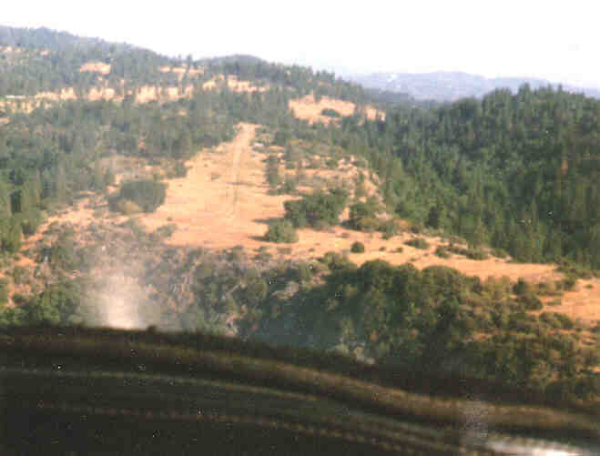
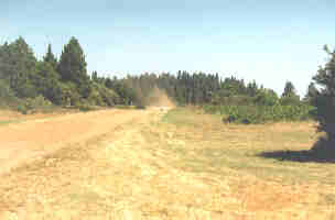
Then looking north into the area where there should be this mysterious air strip.

Looking North

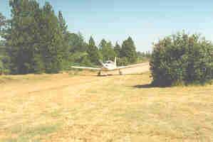
Taxi down to the end of the runway, full power and a practice for soft field takeoff. It’s not really soft, but more oiled gravel – still, you don’t really like to do this for long if you are the one who has to pay for the maintenance. Liftoff, and a quick rocking of the wings abeam the glider flight school to say thanks.

We set the loran to all zero on leaving the airport and head zero-one-zero. When the readout shown 12.5 miles the view confirms what the maps had told us. Still, we circled in bigger and bigger circles but could not make out anything that is or might have been an air strip.

Somebody really has to decode this googledigoog in the logs one of these days.

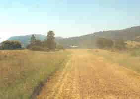
So it was off then to our second target. Stovepipe Wells. We passed California City and did not have to maneuver too hard through this narrow corridor because we got a clearance to enter the MOA and could fly straight towards our goal. Closing in on Death Valley we passed something that surely looked like salt lakes but we were not sure if they really were and we also did not want to stop there to taste.

Salt Lakes

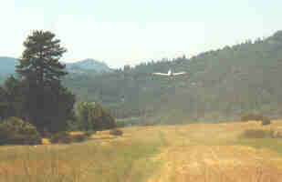
Soon we enter Death Valley, fly up the western valley north hound and then around the bend crossing Stovepipe Wells to take a look at the place of JD’s steamy adventure. Nothing really to see down there except a few parked planes. And as it’s better to get some fuel for the flight back we turn south heading for Furnace Creek.

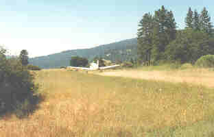
Soon we make out the Death Valley airport and soon are on base turning final.

Base Turning Final

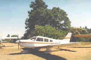
Shortly after that we turn final and ten minutes later trusty 08L is tied down in the strong wind and we are picked up by a courtesy van and taken to the resort where we hope to find a trace of JD Flora.

Final Furnace Creek

Tied Down at Furnace Creek

In the lobby we talk to an old woman who remembers this nice man who gave her such a generous tip and she also recalls the cabin where he stayed and she kept particularly neat for him. She wants to know what happened to this real gentleman, but we have to tell her that we actually are the ones looking for information.

Furnace Creek Lobby

Cabin where JD stayed at Furnace Creek

She asks us to say hi to him when we find him and keep his promise to stay longer the next day and she wonders if the nice lady, who had missed him by just one hour, ever managed to meet him. There! Now we know something that JD did not – hmm…

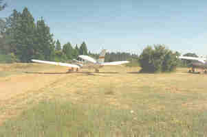
It was time for us to head back, pre-flight and ready to take the desert once more.

Getting ready to take the desert again

08L has the biggest trouble climbing in this hot weather even though – and this was a first – her altimeter was well below zero before takeoff. But we manage to get over these ranges south of Death Valley and as soon as we can reach what’s now Joshua Approach we ask for and get a clearance through the MOA and head straight back towards Burbank. We cross Rosamont Airport and shortly thereafter admire the big runways and markings at Edwards Air Force Base – the alternate for the space shuttles to land when the weather is not good enough for them in Florida.

Rosamont Airport

Markings at Edwards Air Force Base

Things start to look very familiar again now and soon we start to let down and are in our close home territory.

    “Burbank Approach, Cherokee 08L, over Agua Dulce, eight thousand five hundred, landing Burbank with Information Zulu.”

What does ‘cosplay’ mean?

I ran into an articles about Disney Princesses cosplay. The pictures were very appealing, but what the heck is ‘cosplay’?

I had to ask Wikipedia for help and found out:

Cosplay, short for “costume play”, is a type of performance art in which participants don costumes and accessories to represent a specific character or idea. Characters are often drawn from popular fiction in Japan, but recent trends have included American cartoons and Sci-Fi as well as other pop-culture. Favorite sources include manga, anime, tokusatsu, comic books, graphic novels, video games, hentai and fantasy movies. Any entity from the real or virtual world that lends itself to dramatic interpretation may be taken up as a subject. Inanimate objects are given anthropomorphic forms and it is not unusual to see genders switched, with women playing male roles and vice versa.

Cosplayers often interact to create a subculture centered around role play. A broader use of the term cosplay applies it to any costumed role play in venues apart from the stage, regardless of the cultural context.

All right, that makes a lot of sense, and now we can enjoy the pictures of a group of  pretty girls cosplaying (can you use that as a verb? – maybe I just created that now.) roles from all our favorite Disney princesses and the like. There is actually something I had admired about these princesses, or better about their creators. They had been created to appeal to the whole family. The little ones liked their cartooniness, but they also were pretty so that the older female viewers could use them as models to strive after. And for the older males the characters were just a bit of sexy with nice appealing curves. I was always amazed by this delicate balance.

Now, these cosplaying women have definitely lost the cartoon character and I don’t know if they still want to appeal to the female population, but they certainly do to the male customers.

So, here for the enjoyment of whoever wants to…

Angeles Crest Highway (Hwy 2) Finally Open Again

After being closed for more than four years, the Hwy 2 between La Canada and Wrightwood is finally open again! Rumors were heard in April that May would see the day when repairs would finally be completed.

A landslide had taken down part of the road in 2004. Estimates had then been that it would take until 2006 to have those damages repaired but in 2005 more landslides had destroyed even more of the road and so to took a bit longer – three years to be exact.

The latest rumor was that the road would be open for Memorial Day 2009 – which was last weekend. So, on Friday, to avoid the traffic on the 210 and 15 going around the bend, we drove up Hwy 2 in the hope that rumors would be true.

And they were! At the turn-off towards Palmdale, the Angeles Forest Highway, there was the sign: Wrightwood – Open!

Traffic was very light probably because the new (old) road will have to be re-discovered by the residents over time. We were not the first to take the road this Friday but certainly were amongst the first. We did not save any time in comparison to taking the 210 and 15 (without traffic) but the ride was definitely much nicer.

On the following Monday we took the same route back, for one expecting traffic on the 15 and 210 flowing back into LA but also to set the trip counter to see how long it really is – not trusting Google Maps completely yet.

And it was a beautiful drive! Saw two deers on the road – I guess they will also have to rediscover that its not all their turf any more – some mini-glaciers and beautiful scenery…

hwy2-reopened-01-20090526

hwy 2 reopened - 03

So, what’s the result of the distance measurement with the trip counter? Google Maps is pretty close and if you just want to get there with the least costs it is probably better to take the trip around the bent through Rancho Cucamonga (love to say that) when going outside of the rush hour – easier drive, less wear on the car and possibly a bit shorter on the clock, not on the odometer – that’s about seven to eight miles more.

But it is great to have the option of taking the leisurely drive through beautiful mountains.